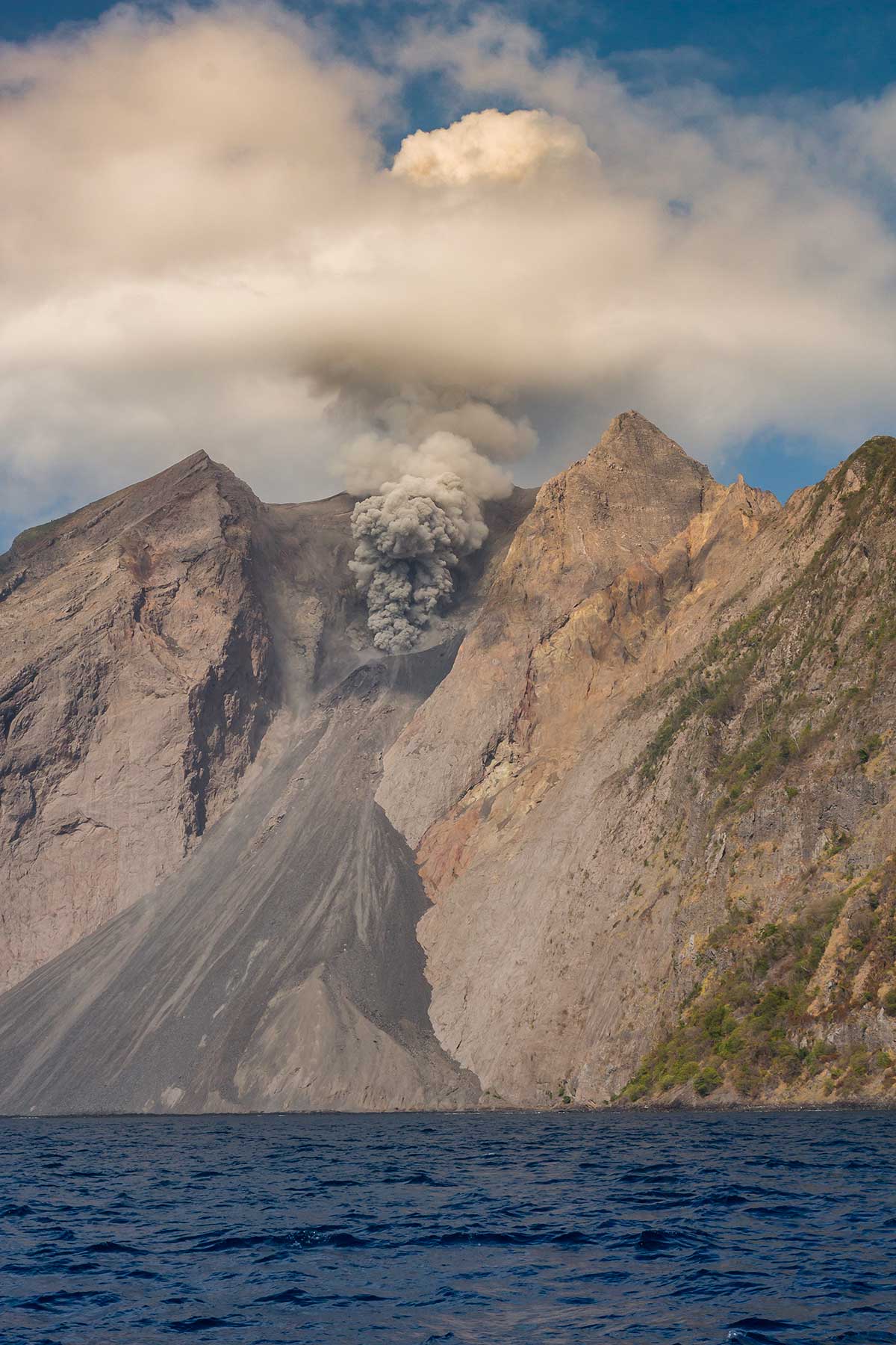
Komba Island is a small isolated volcanic island located in the Flores Sea, Indonesia. The island is administratively part of Lembata Regency, East Nusa Tenggara. it is located approximately 70 km northeast of Lembata Island. The island contains Mount Batutara, a volcano that erupts in every 20 minutes.
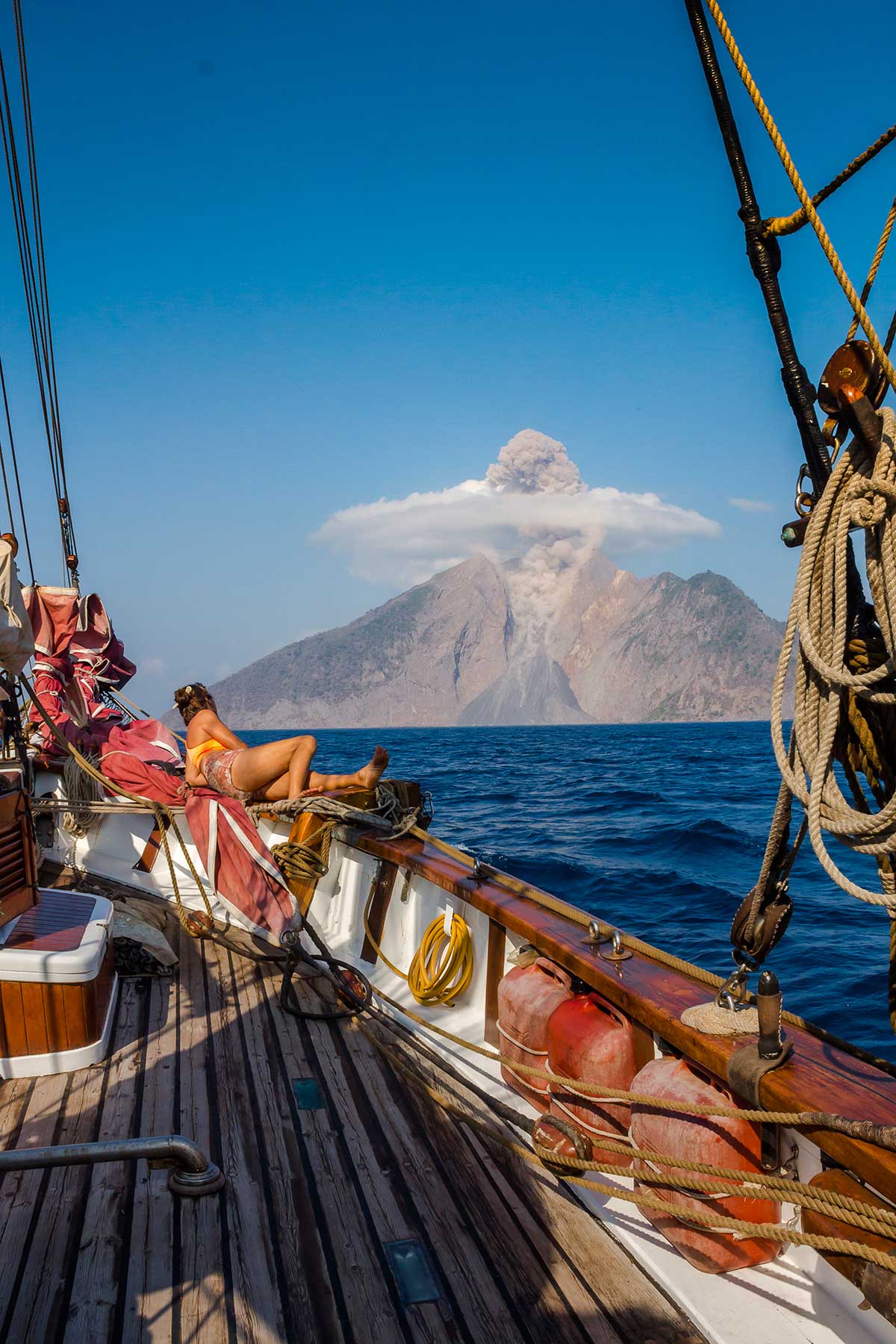
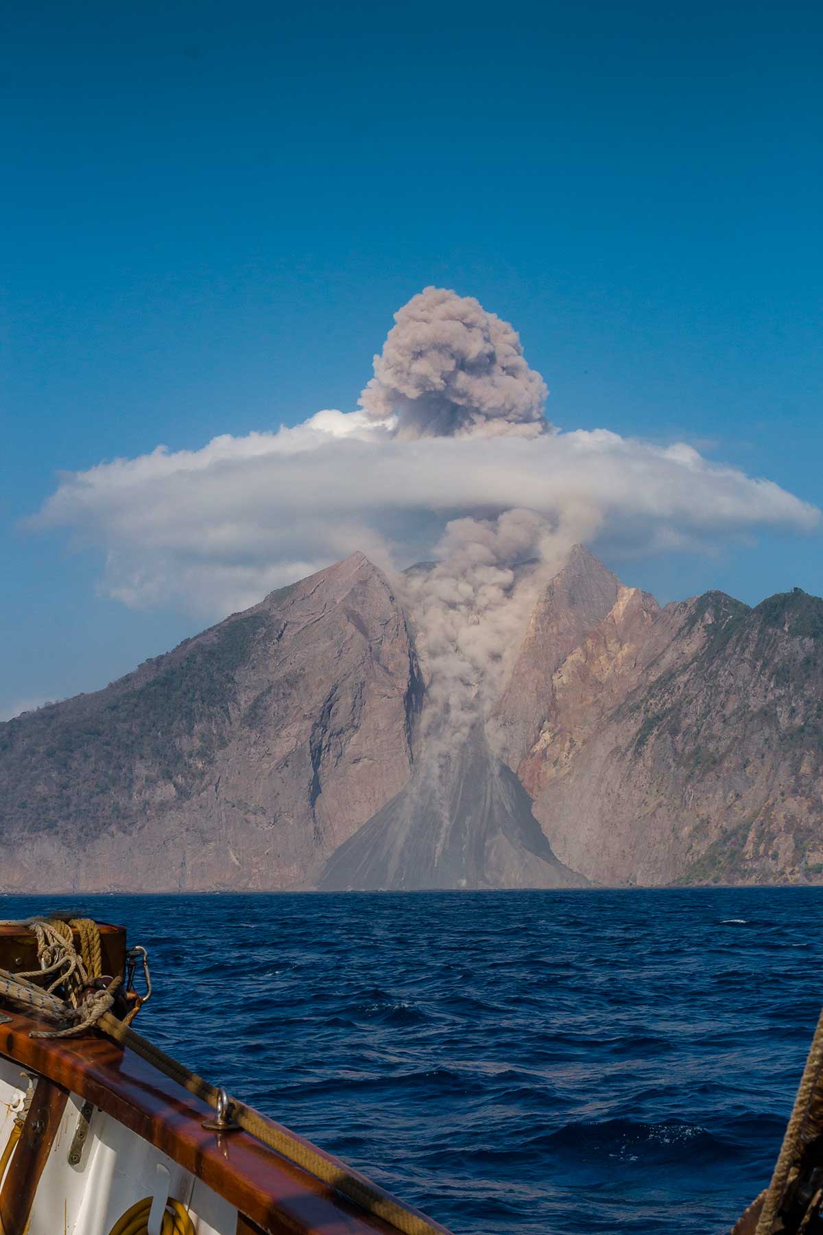
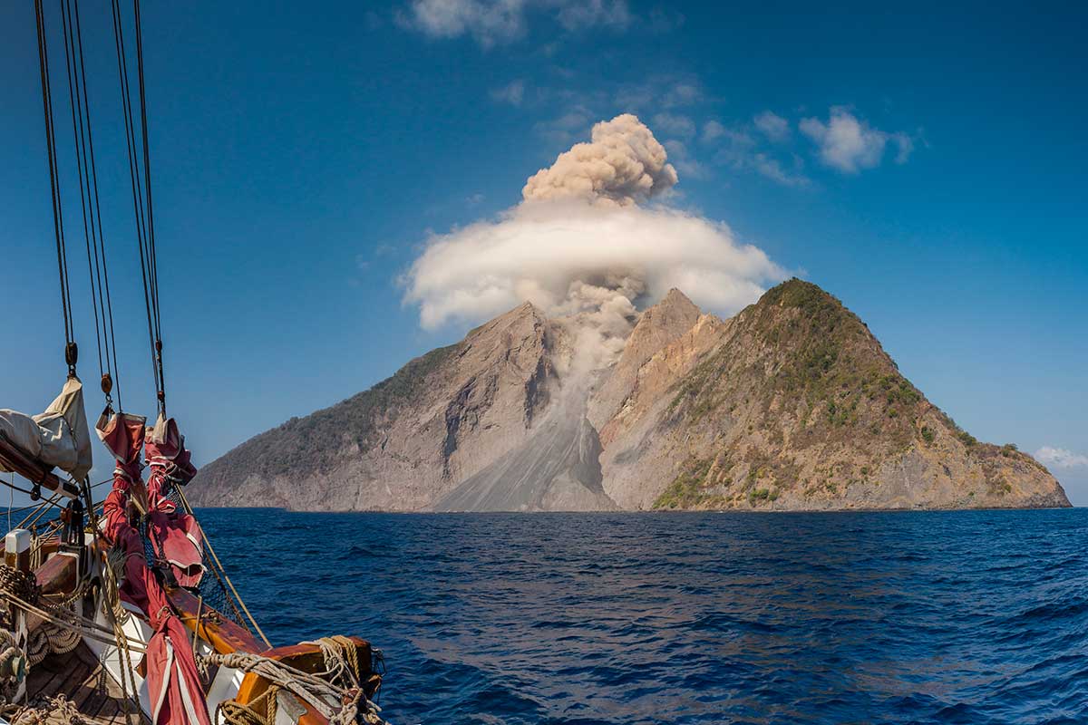
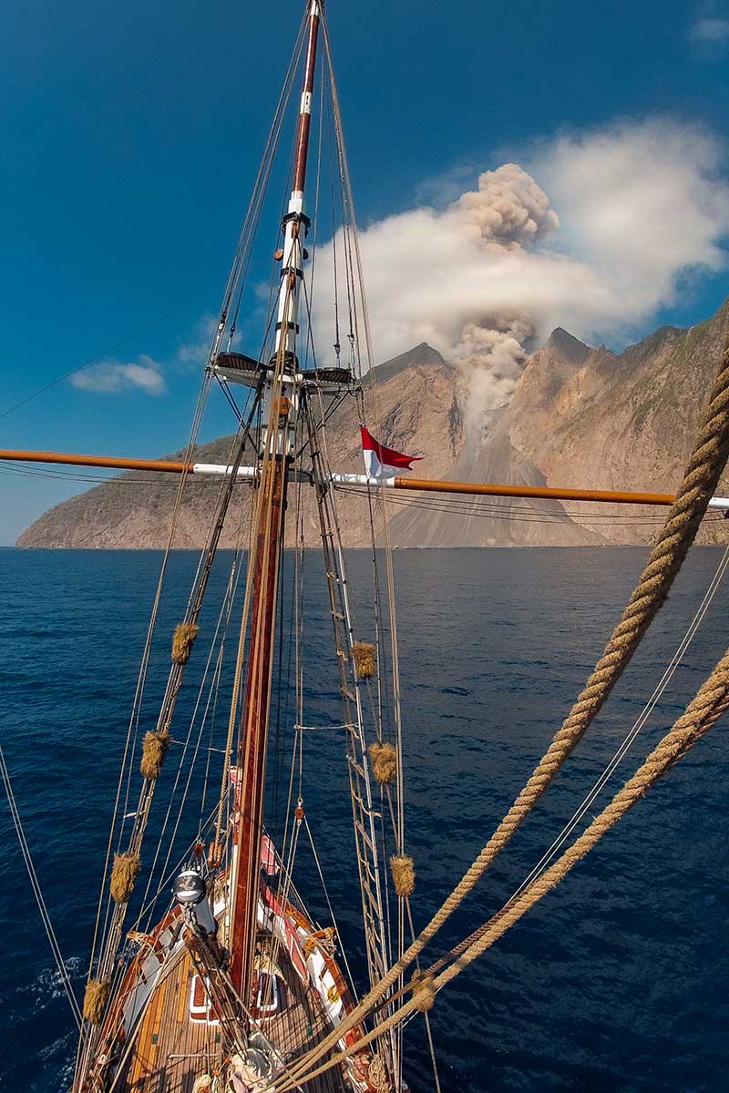
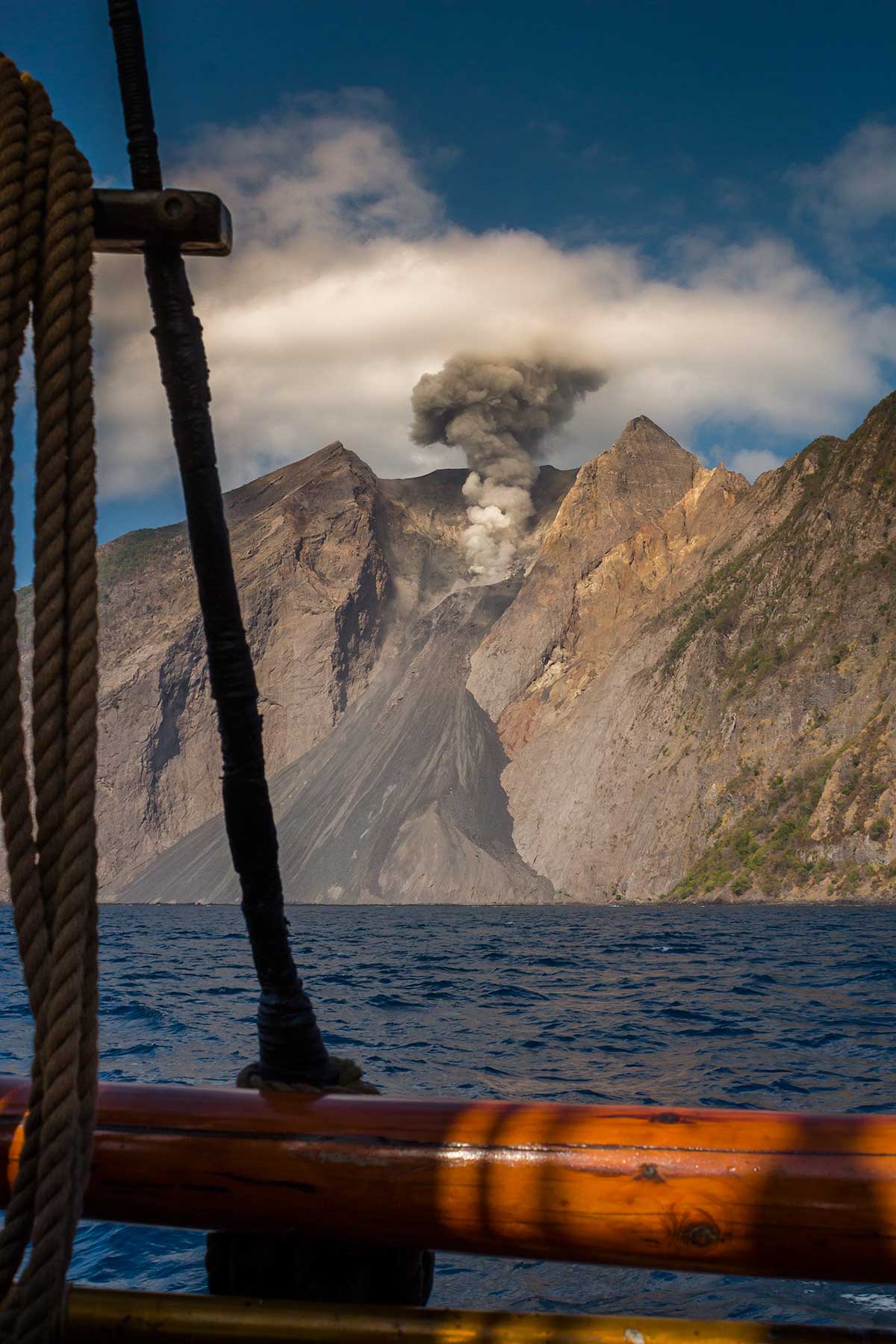
The remote Komba island consists of an active volcano, Batu Tara, whose first known eruption was in 1852. In November 2015, We sailed on Historic vessel Vega in the eastern islands of Indonesia and were fortunate to visit Pulau Komba (aka Gunung Batu Tara) and watch its eruptions which occurred every 5-10 minutes.
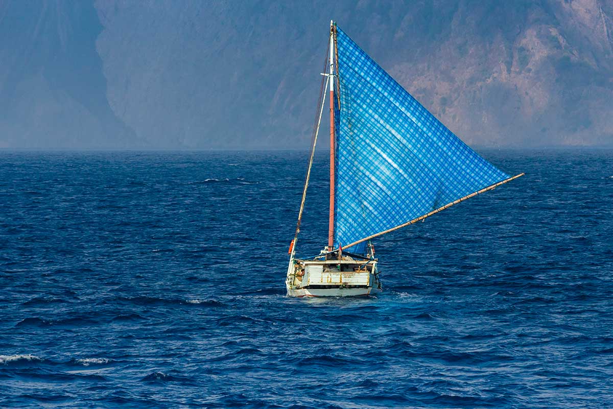
Pulau Komba is an oceanic, volcanic mountain rising from the seabed below. There are no other surrounding islands. It lies about three hours of sailing time off the north coast of the Pulau Lomblen in Nusa Tenggara Timor in the Java/Sunda sea.
Our paper charts, dated 1999, give the name of this island as Pulau Komba. While the marine/navigational details on these charts may be current, it seems that names of landmasses are still from colonial Dutch times. On our more recent C maps, Pulau Komba is known as Gunung Batu Tara.
We have passed Pulau Komba several times in recent years and it has been erupting for quite some years. During our recent visit, it erupted every 20 minutes with enormous plumes of smoke. At night, we were sitting about half a kilometre off the island, directly in front of the crater and its lava flow into the sea. As the sun fell, we could see the fiery eruptions and lava cascades into the sea. The thunderous noise of each eruption, which reached us some seconds after seeing each eruption, was enormous.
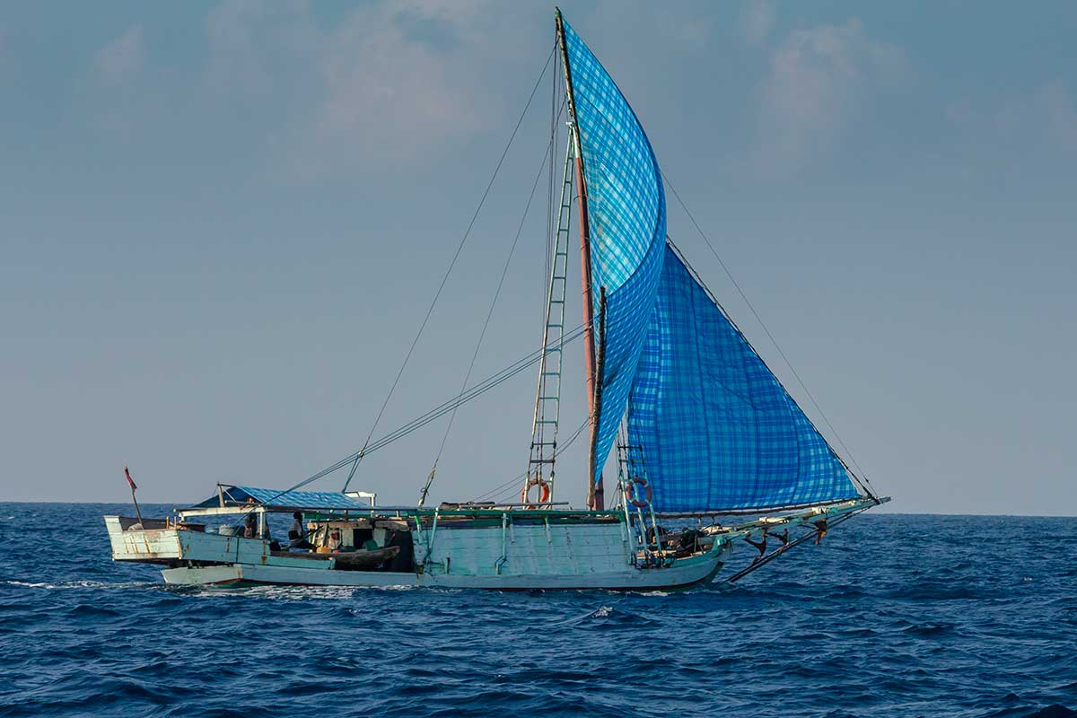
It is difficult to reach this island unless travelling on a boat, as we did. Moreover, it would be inadvisable to try to climb its peak in view of its persistent, frequent and intense eruptions.


